Kyuya Fukada, a Japanese writer and mountaineer, established the list of “100 Famous Japanese Mountains” in 1964. This list has become famous and is considered a must-visit destination for hikers with a serious interest in hiking.
Mt. Nantaisan is one of the mountains on this list and is located in Nikko National Park in Tochigi Prefecture. It is known for its beautiful views of Lake Chuzenji and the surrounding area.
In late September 2014, I took on the first challenge of “100 Famous Japanese Mountains” by climbing Nantaisan. The reason was that a friend of mine had shared a very beautiful photo from the top of it on social media. So I decided to go for it.
It’s no exaggeration to say that I became fascinated by the mountain through this climb and hiking became my hobby. It was very mysterious to see a big sword stuck at the top of the mountain.
The view from the summit was also breathtaking.
Profile of Mt. Nantaisan
| Elevation | 2,486m |
| Hiking difficulty | Middle |
| Required walking time | 6.5h |
| Total walking distance | 8.7km |
| Cumulative elevation difference | 1,220m |
| Climbing Season | May to Oct. |

Nikko Futarasan Jinja Chugushi Shrine, the trailhead, is accessible by bus from Tobu Nikko Station.
When climbing Mt. Nantai, visitors are required to submit a climbing plan and pay an entrance fee (1,000 yen as of 2023) at the shrine at the foot of the mountain.
My Course time
My course time was about 6.5 hours to complete.
| Walking time | 6 hours 5 minutes |
| Break time | 30 minutes |
| Total time | 6 hours 35 minutes |
10:25 Futarasan Jinja Chugu Shrine (Start)
13:55 Fourth station
14:00 Summit (30 min. rest)
16:00 Fourth station
17:00 Futarasan Jinja Chugu Shrine (Goal)
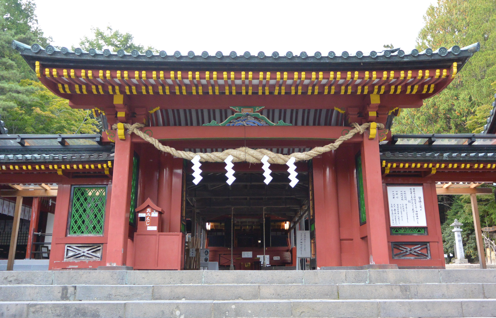
The start is at this shrine; paid 1000 yen and entered the trailhead.
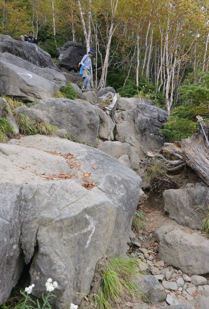
Climbed up a rock with large steps.
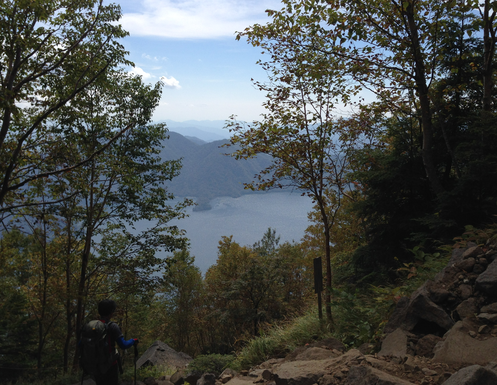
After the fifth station, you can look out over Lake Chuzenji. The slope was a little tough.
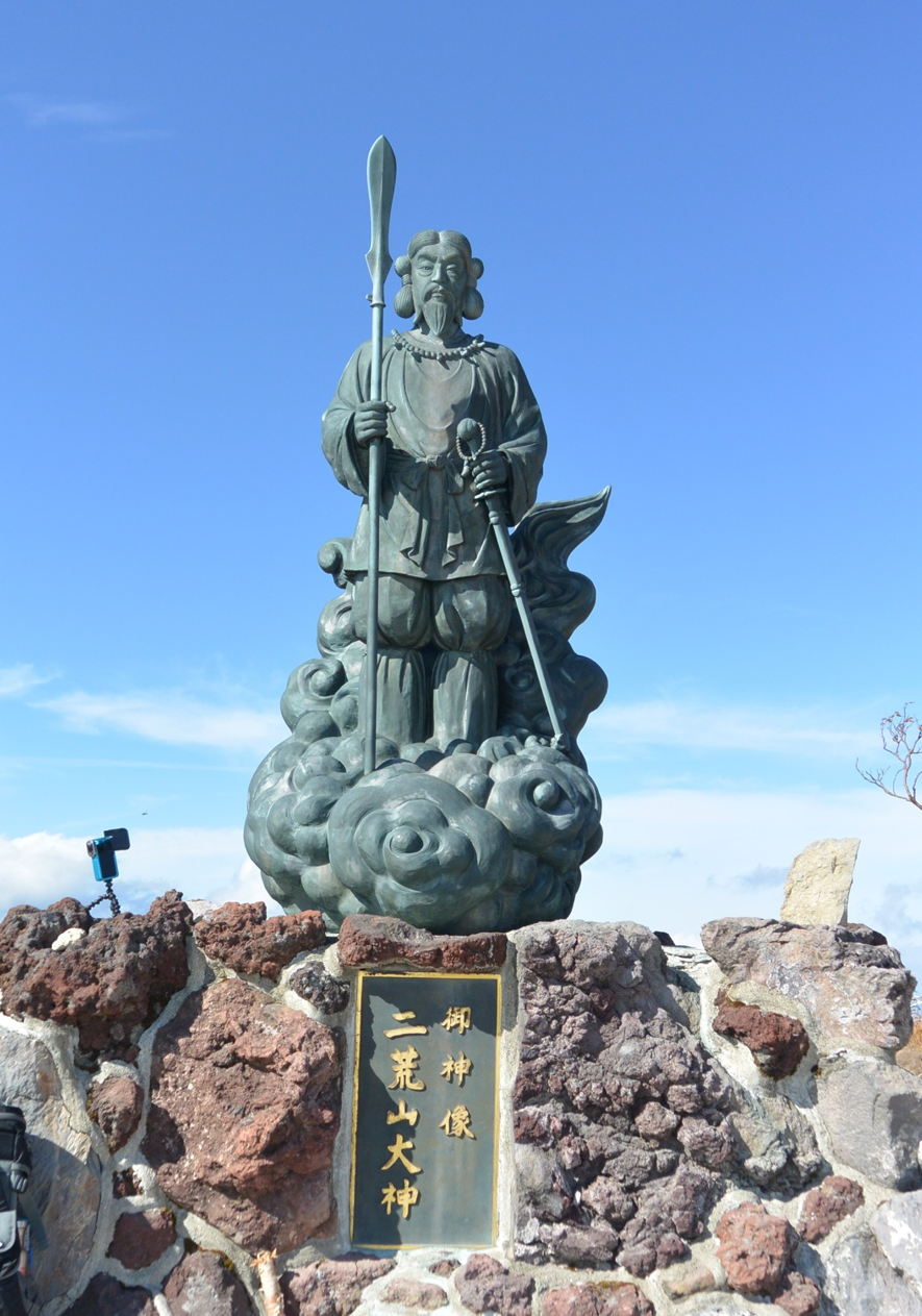
When I reached the top, I found a statue of a Japanese god.

This sword looked like Excalibur. How many years ago was it installed here?
 On a clear day, a 360-degree view of Mt. Fuji, the Northern Alps and the mountains of Oze can be seen in the distance.
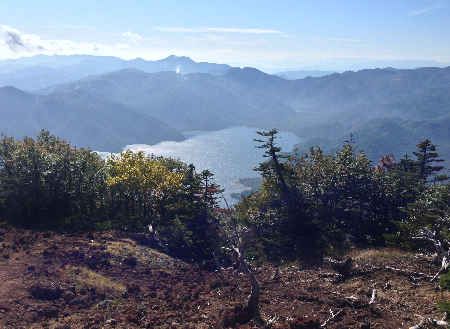
Both uphill and downhill climbs offer views of Lake Chuzenji.
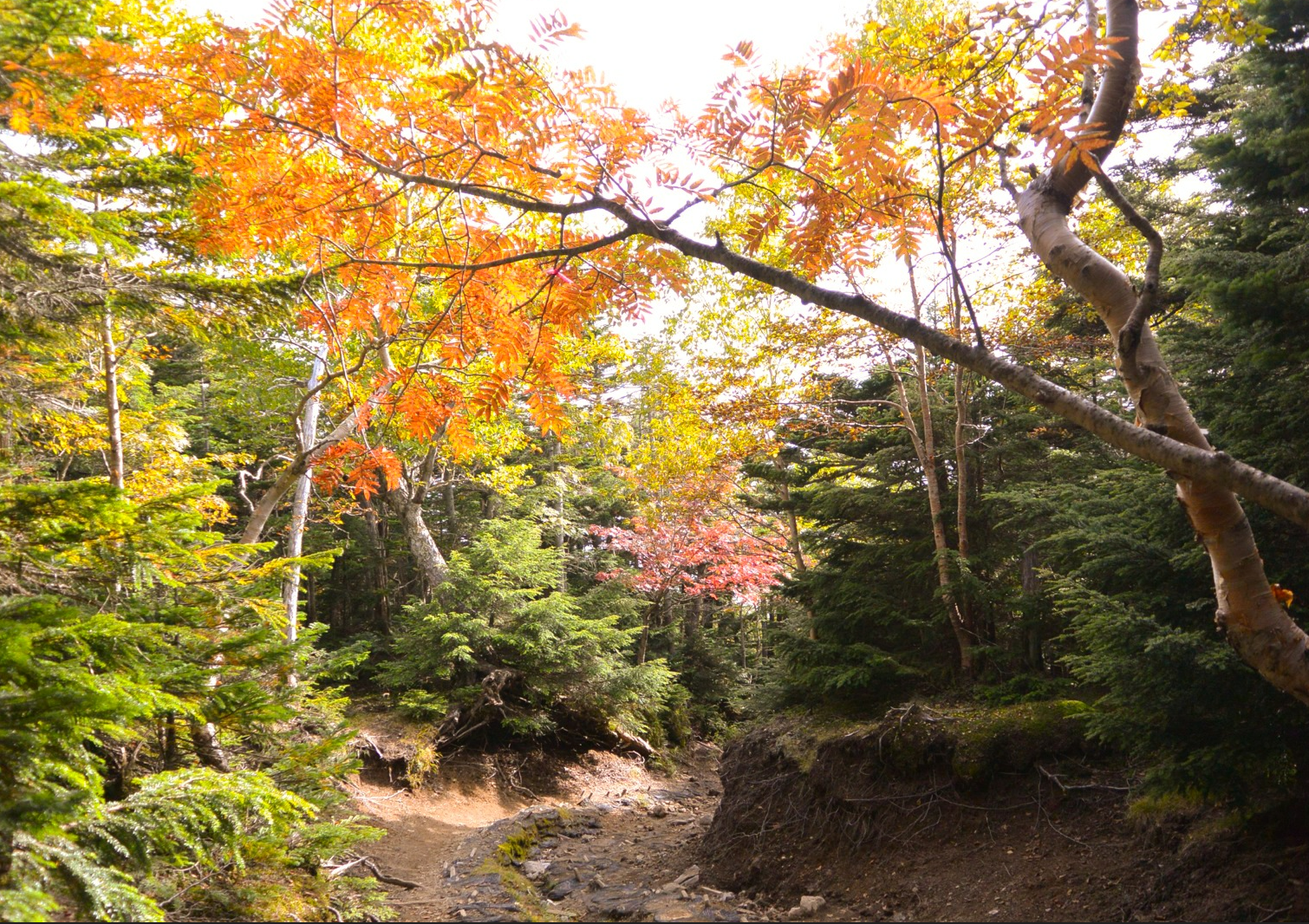
It was late September, but I was able to enjoy the autumn leaves on the trail.
I saw a man who had broken his leg on the way down, probably because of the hard steps and slopes.
He was being helped down the mountain by his friends and looked like he was having a hard time.
There are no mountain huts along the way, so it is necessary to prepare drinks and food before climbing the mountain.